Colorado High Country Bike Tour
Introduction
Two years ago, Stephen and I finished our Grand Canyon Connector Bike Tour.
Riding on a wave of enthusiasm, we started thinking about what’s next. Now that we beat the heat, what would push us even harder?
But just as we started getting into planning mode in early 2020, COVID hit. We were forced to hit pause and wait. The question still bugged us though: What comes next?
Scrolling through the ACA tour catalog, we eventually found our match: Colorado’s Classic High Country.
Planning
To plan the route and itinerary, we took an existing guided ACA tour and modified it to fit our criteria:
- an 8-day trip excluding travel days
- 60 miles a day
- a mix of camping and motels
In the end, we did modify the route further by trimming down day 5 and skipping day 6 due to an interstate closed by a mudslide. Here is the RideWithGPS route that I created for the trip:
And the itinerary:
| Day | Date | End At | Mileage / Elevation | Accommodations | Notes |
|---|---|---|---|---|---|
| 0 | Fri, Aug 6 | Home -> Frisco | Motel - Snowshoe Motel | Stephen and Ryo land in DEN and take a shuttle to Frisco. | |
| 1 | Sat, Aug 7 | Hot Sulphur Springs | 60 mi +1966 ft / -2732 ft | Motel - Hot Sulphur Springs Resort | Resort comes with access to their 19 pools of hot spring water. |
| 2 | Sun, Aug 8 | Walden | 61 mi +2882 ft / -2412 ft | Motel - Antlers Inn | Only mid-route services for this day is 40 miles in at Rand. |
| 3 | Mon, Aug 9 | Steamboat Springs | 63 mi +2801 ft / -4055 ft | Camping - KOA Steamboat Springs | No mid-route services on this day. Bike shops available at Steamboat Springs. |
| 4 | Tue, Aug 10 | State Bridge | 63 mi +3500 ft / -3352 ft | Camping - Rancho Del Rio | A few mid-route services at Oak Creek, Philippsburg, and Yampa. |
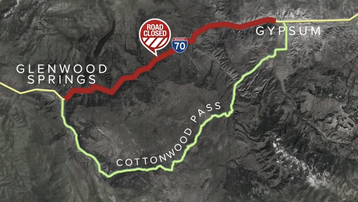
| 5 | Wed, Aug 11 | Glenwood Springs | 60 mi +2021 ft / -3186 ft | Camping - Ami's Acres | A mudslide has closed I-70 between Gypsum and Glenwood Springs. Alternate route is Cottonwood Pass, but does not look bicycle friendly. |
| 6 | Thu, Aug 12 | Aspen | 41 mi +2205 ft / -52 ft | Motel - Mountain Chalet | Consistent climb up to Aspen. |
| 7 | Fri, Aug 13 | Leadville | 55 mi +5265 ft / -3662 ft | Camping - Sugar Loafin' | Biggest climb of the trip: Independence Pass. Wake up early to avoid traffic. |
| 8 | Sat, Aug 14 | Frisco | 34 mi +1927 ft / -2471 ft | Motel - Snowshoe Motel | Shorter final ride back to start of loop. |
| 9 | Sun, Aug 15 | Frisco -> Home | Take the shuttle back to DEN in the morning, fly home. |
Due to how desolate parts of the route are, we also purchased a bicycle roadside assistance plan offered by Better World Club. For a pretty reasonable annual price, they offer roadside assistance on any road in America.
Stephen and I both shipped our bikes from local bike shops to a shop in Frisco, Rebel Sports.
Gear
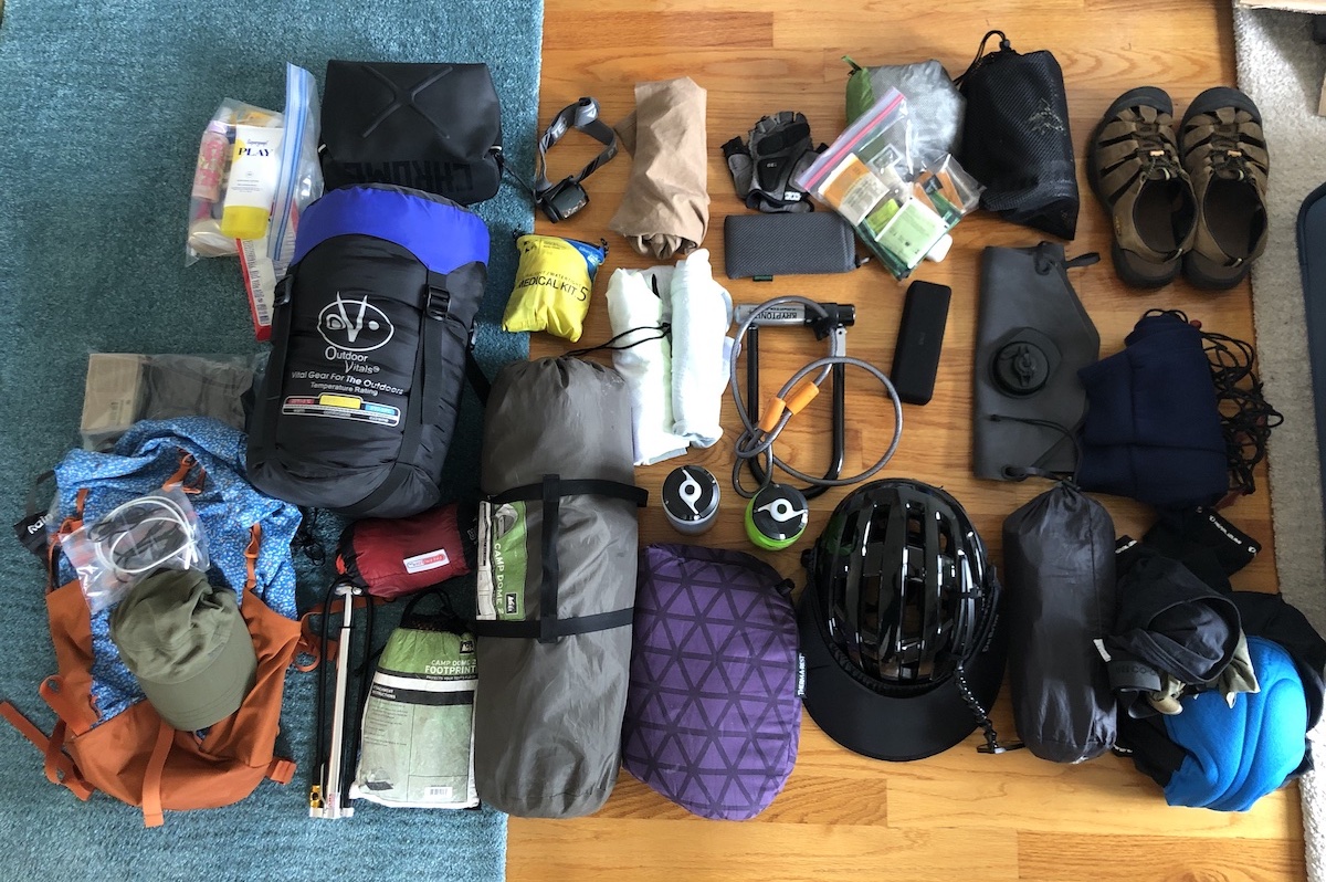
Luckily, I had most of the necessities for a tour like this from a previous tour. Overall, I would say that I slightly over-packed for this trip. if I had to do this trip again, I would bring fewer socks and skip the bike lock. Here’s what I took:
Clothing
- hiking sandals (Keen Newport)
- 3 pairs padded bike shorts
- 3 underwear
- 9 regular pairs socks
- hybrid regular / swim shorts
- padded cycling gloves
- warm outer layer
- 3 long sleeve cycling jerseys
- 1 cotton shirt
- ear mitts
- sunglasses
- rain jacket
- sleeping mask
Toiletries
- body wash
- sunscreen
- toothpaste / toothbrush
- first aid kit
- wet wipes
- paper towels
- lip balm
Cookware
- jetboil
- spork
- backpacking meals
Bike Tools
- air pump / patch kit
- 3 extra tubes
- tire levers
- multitool
- bike lock / tire cable
Utility
- cash
- handlebar bag
- Grand Canyon Connector ACA map
- 26800mAh power bank
- charging cords
- water storage bag / water bottles
- wireless headphones
- rearview mirror
- bike lights
- mini inflator (for sleeping mat)
- headlamp
A few of these were new additions:
Lezyne Micro Floor Drive Pump
We discovered from the last tour we were losing ~30 PSI a day, which led to noticeably increased rolling resistance over time. This led to us regularly checking for places where we could top up our pressure. Not sure whether the root cause was the added weight, something with our tubes, or temperature/elevation changes, but this pump eliminates the problem by enabling floor pump levels of pressure anywhere.
Mini Inflator for Sleeping Mats
After years of ending the day with the dizzying ritual of blowing the sleeping mats the old fashioned way, this small luxury will do it for us with the press of a button.
Helmet Visor and Mirror
After some searching, it looked like the Da Brim Visor and EVT Mirror are the most popular niche brands. Previously I’ve used a Take-a-Look mirror which is mounted on the glasses instead of helmet. To keep the Take-a-Look mirror from slowly weighing the glasses off of my face, I added a glasses retainer strap, but that led to chafing behind my ears, so this time I took taking a helmet-mounted approach.
Knockoff Jetboil
I’ve used a cheaper backpacking camp stove for a long time which required 7-10 minutes to get water to boil. Now we can have hot water in 2 minutes and not worry about running out of fuel.
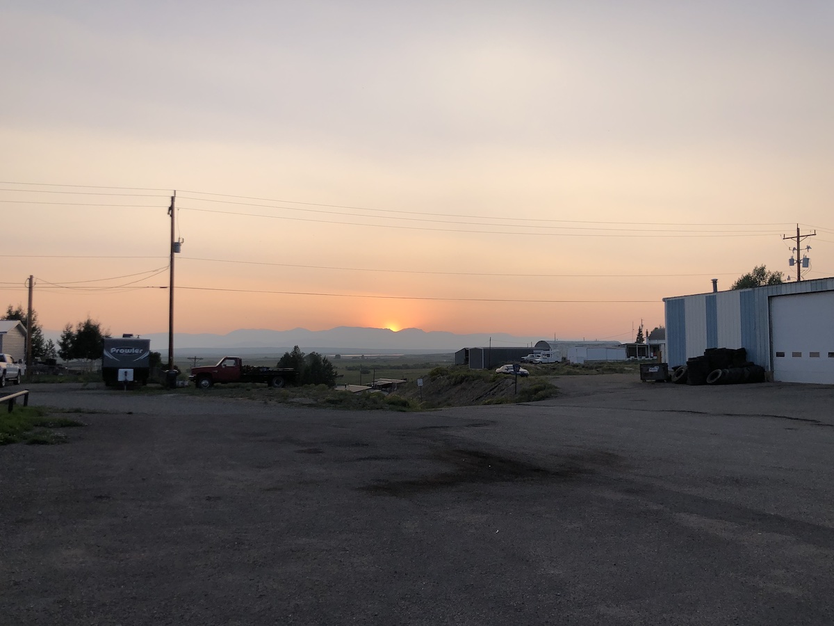
Day 0: Flight to Denver, Shuttle to Frisco
After many days of planning and packing, I’m finally at the airport ready to fly to Denver.
Last year, Stephen and I decided to cancel our annual bike tour due to COVID, but not this year. Vaxxed and ready to hit the road, we planned a weeklong loop in the mountains of Colorado.
The big challenge last tour was heat. This time, it’s altitude. Starting at 9k feet in Dillon and eventually climbing to 12k feet at Independence Pass, the available oxygen almost halves compared to sea level (20.9% to 13.2%).
Right before boarding the plane, I discover that part of the route, interstate 70 between state bridge and glenwood springs is impassable due to a mudslide. One alternative is a windy local road, Cottonwood Pass. It’s described as a “secret, unsafe shortcut”. A local news station describes it below:
It’s something we’ll have to plan around, but since it impacts day 5, I decide we can improvise when we get closer to the day and we get a better understanding of the conditions and our ability to meet them.
I meet Stephen at the airport and chat while we wait for the shuttle to take us to Frisco. The van ride is uneventful but it’s our first transition to the thinner air. We feel our ears pop as we drive through tunnels and up a gradual incline.
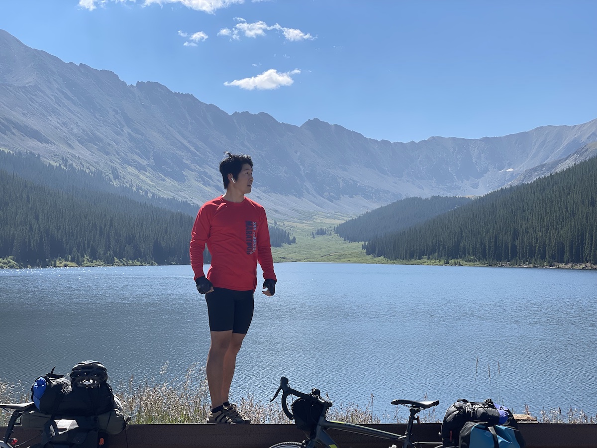
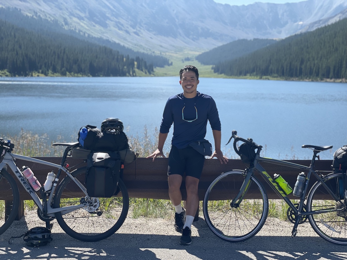
Day 1: Frisco to Hot Sulphur Springs
In the night my sleep is interrupted by dreams that take place in our hotel room. In one, another guest enters our room by mistake and is frightened and runs out.
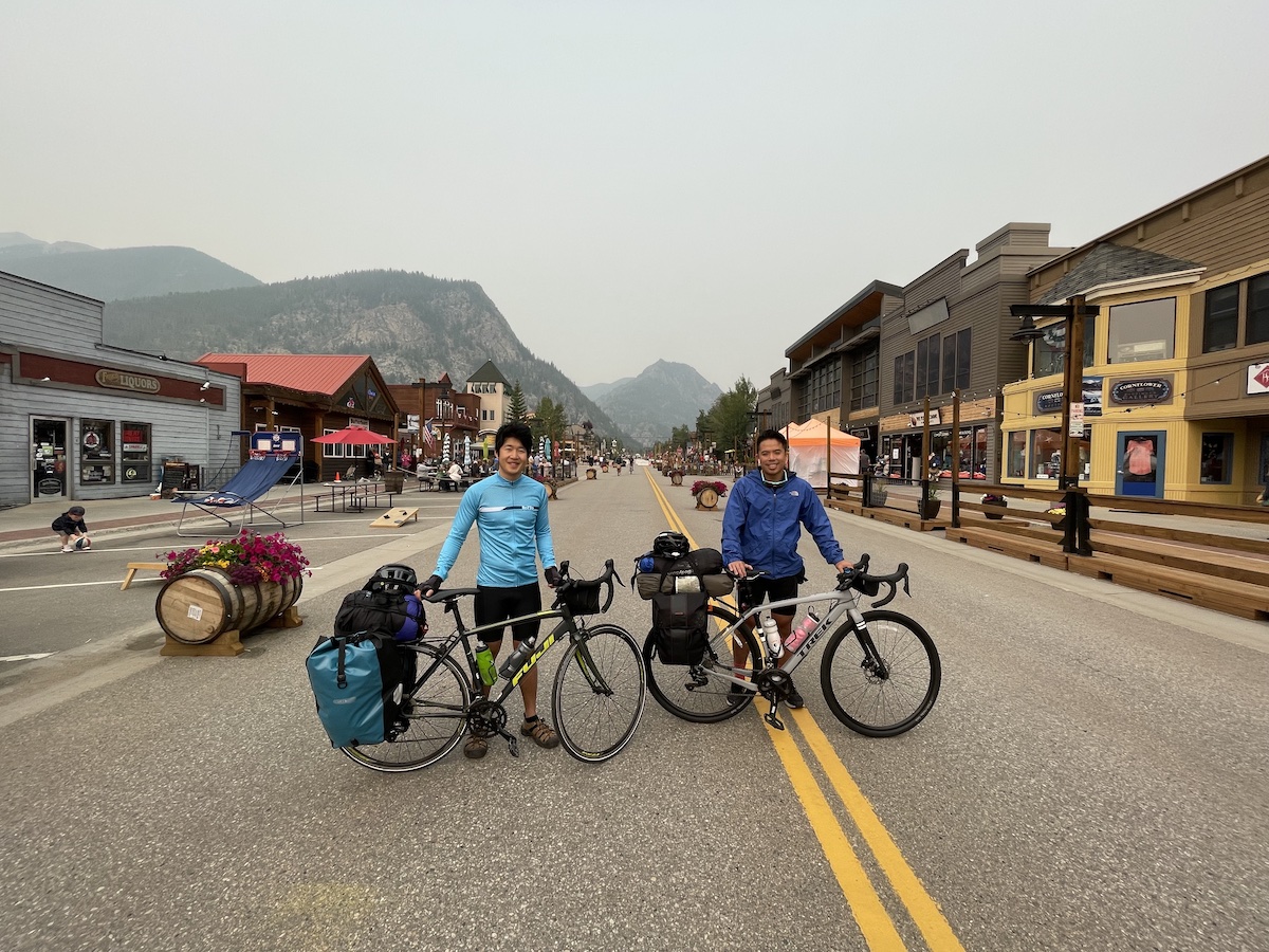
We pick up our bikes from Rebel bikes, take some photos in downtown Frisco, a cute tourist street, and head out on adventure. But not quite. We go to Walmart, REI, City Market, and finally McDonalds and by the time we know it, it’s noon and we’re just heading out of town.
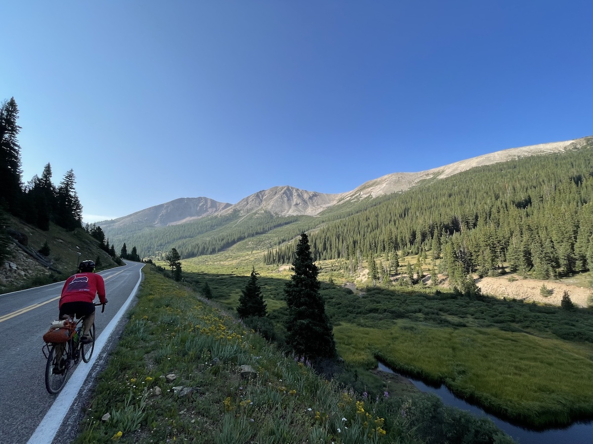
The air is hazy from smoke, but the thin air makes a bigger impact. It’s subtle but constant. Everything is just slightly harder. There was no single point where we had a headache or felt nauseous but we could tell that we were running out of energy faster.
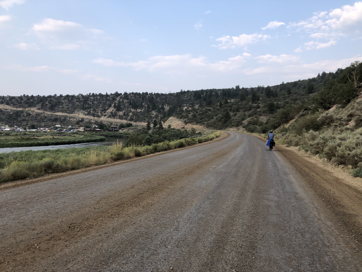
The route was overall downhill today. 60 miles mostly on single lane roads with lots of traffic.
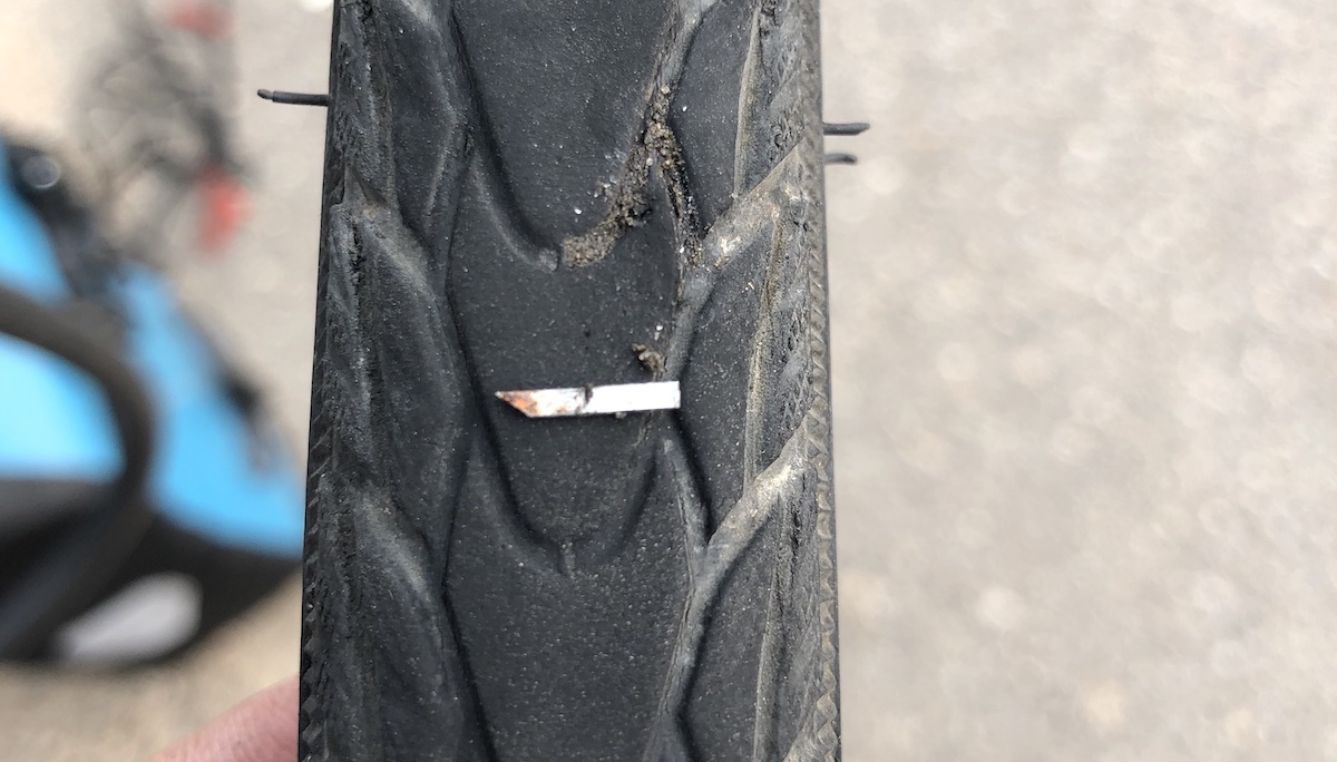
I get a flat on what I thought were impenetrable tires. A sharp metal shard of the perfect length to penetrate a tire did it in. We patched it, but should’ve just replaced the tube because the patch kept leaking.
In patching my tire, we broke a tire lever but luckily we’re saved by a bike shop in Kremming. While resting at a Mexican restaurant I went to see if I could get an extra set, the store appeared dark and closed but there was a small sign that said “by appt, call xxx-xxxx”. I called and a big dog ran up and an old man who said “young man what can I do for you” sold me the levers.
I notice that here people stop to ask if you need anything if you are fixing your bike on the side of a middle of nowhere road.
For the last 10 miles I have to continuously choose between stopping to pump up my slowly deflating patched tire and get eaten by mosquitos or continue arduously pedaling on a mostly flat tire.
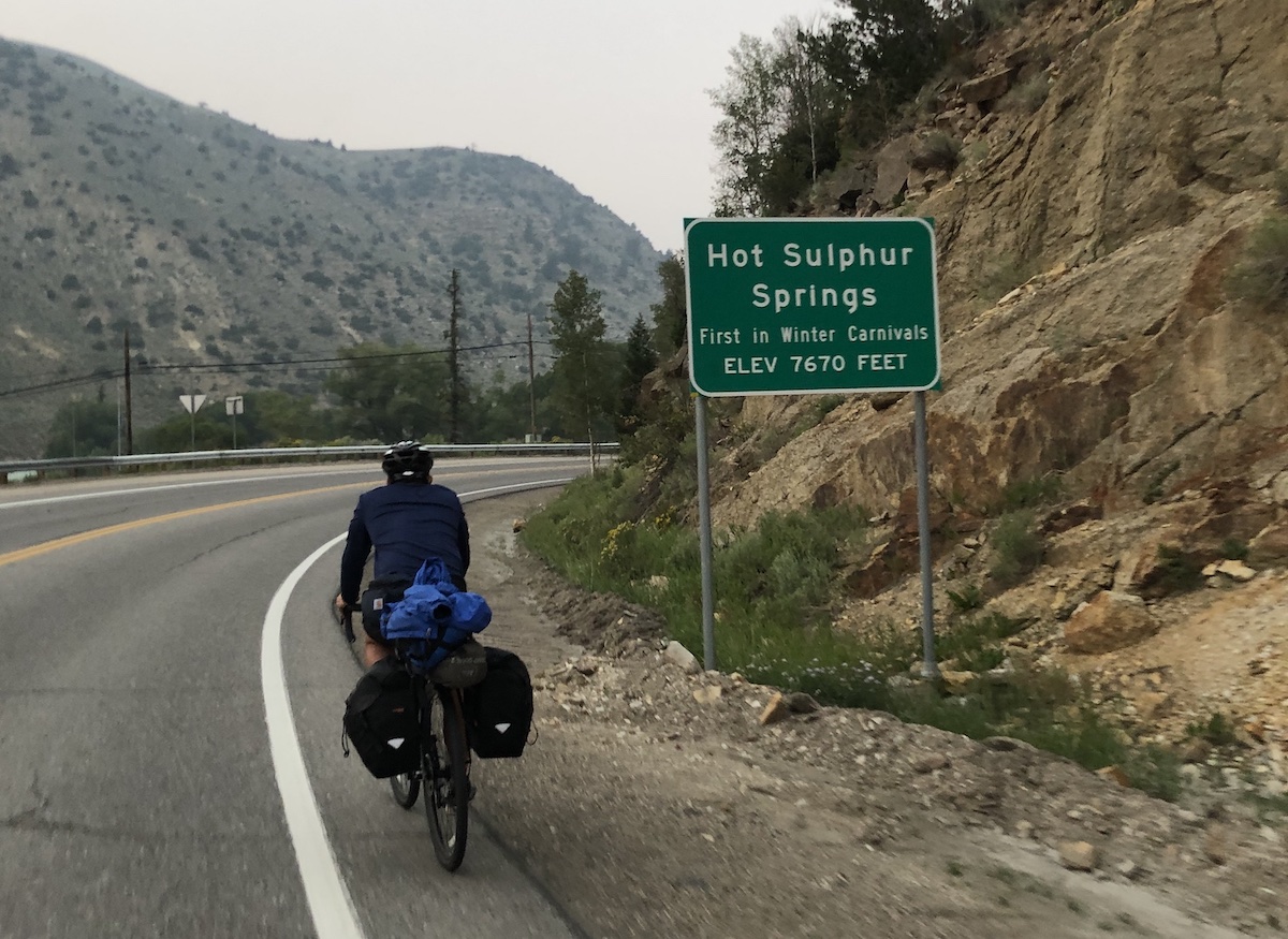
I feel incredibly relieved when we finally got to Hot Sulphur Springs just as it was getting dark. Although the ride today was mostly downhill, it was surprisingly strenuous. I get a certain feeling, and one that I’ve had before at around mile 2-3 of a marathon. This regretful feeling of “What did I get myself into?” It always passes but I can’t help feeling it in the moment.
The motel allows us to indulge in the town’s namesake 19 pools of hot water. A relaxing end to the day.
Day 2: Hot Sulphur Springs to Walden
Again, I have some trouble getting a full nights sleep. We head out at 9am, looking for a place in town for breakfast and not finding any so eating a few bars and starting our way out to Walden.
The haze is thinner today, and it feels like we are more acclimated to both the elevation and the idea of cycling all day. The first half of the ride is a climb that reaches a point on the continental divide.
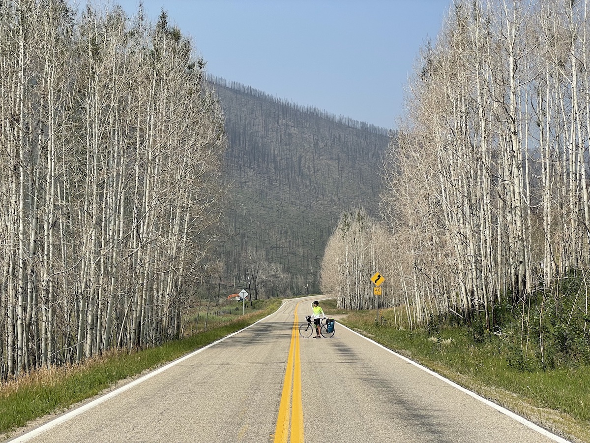
We ride along a scenic mountain stream. All around us are peaks littered with trees defoliated by wildfire. Evidence of last weeks mudslides are on the side of the road. Tired and hungry, we stop halfway to make a backpacking meal. We pledge to make breakfast a priority moving forward.
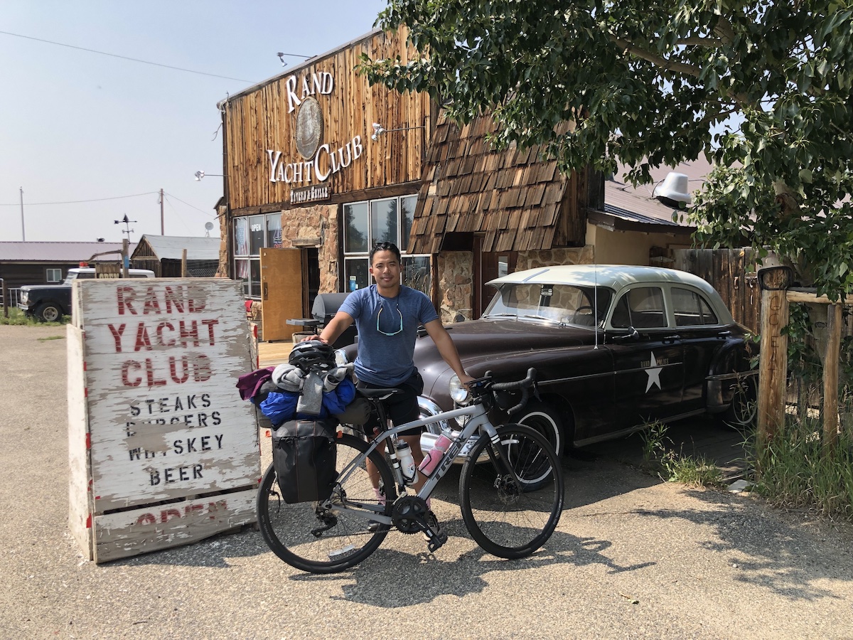
After a considerable descent, we are out of the forest and now are on the plains. Reaching Rand, we are relieved to sit at the one restaurant, the Rand Yacht Club and enjoy a pitcher of ice water and big plates of steak and chicken tenders. I was quite impressed with the meal, especially given the remoteness of the town.
20 final miles to Walden. Mostly flat, gently rolling roads cutting through big green pastures make for easy riding compared to earlier in the day. Herds of cows stand at attention and stare at us as we pass.
In Walden, I go to the coin op laundry in town, the building is a bit rickety but the machines work. I look outside the window and wonder how I ended up in the small town laundromat. We stay at the Antler’s Inn, which is done up in all sorts of taxidermy decorations in a hunters cabin style.
Day 3: Walden to Steamboat Springs
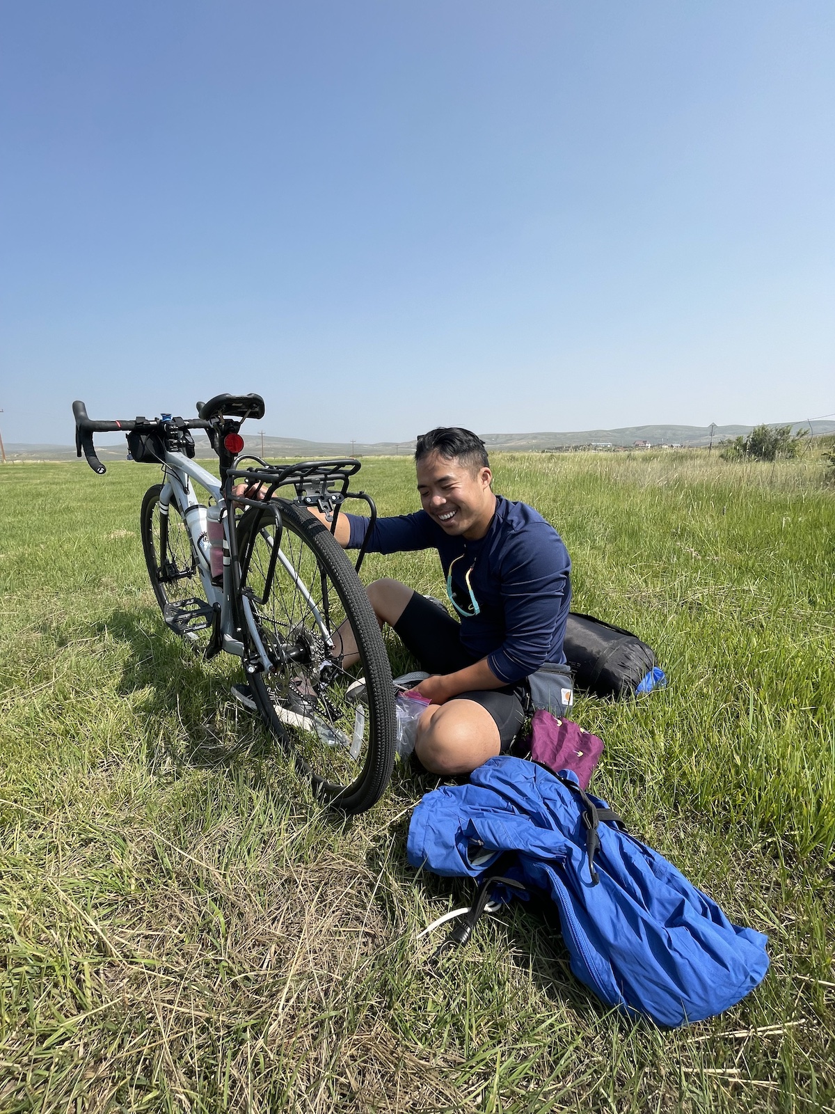
First restful sleep of the trip for me. I wake up feeling refreshed and ready. I have two giant pancakes for breakfast. We do a little bit of bike troubleshooting, Stephen’s rack is coming loose due to part of the frame’s thread being stripped. I notice that my wheel has a slight wobble. It appears that my hub is loose. We resolve to make it to the next town before the bike shops close.
After getting snacks at the gas station, we head out into the open plains. It’s hotter today with less haze to cover the sun, but more scenic. We pass sporadic ranch homes. Some dilapidated and some grand. The occasional oil Derrick. We share the two laned road with an minivans of families, biker gangs, horse trailer carrying pickups, and the occasional half-house on a semi (oversized load).
Part of the way Stephen’s rack comes off again and we pull out to a grassy patch to troubleshoot. Very luckily Stephen brought a couple backups for the screw in various lengths and we are able to secure the rack to the frame. Preparation paying off.
Not long after stopping to make the repair, we stop on a gravel patch beside the road to make refuel ourselves with some Cup Noodle.
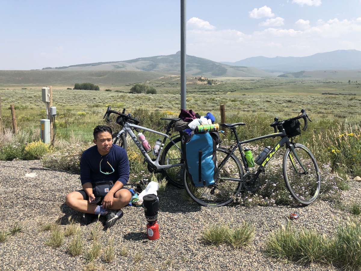
Next challenge is a 3 mile climb along a busy highway. Lots of fast moving traffic but the road alternates between wide medians and an extra lane, making it do-able.
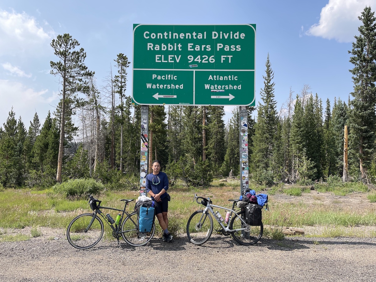
We pose in front of our second sign marking the continental divide, Rabbit Ears Pass. It seems like this tour is all about criss crossing the divide much to the detriment of our legs. But we are rewarded with a 7 mile 7% decline with fantastic views of the land and lake below. We’re flying down the road, I try to pump the brakes occasionally to avoid going too fast but at some point I accept the risk and ride fast to allow myself to get to the bottom in reasonable time. We’re lucky that the road is clear of debris.
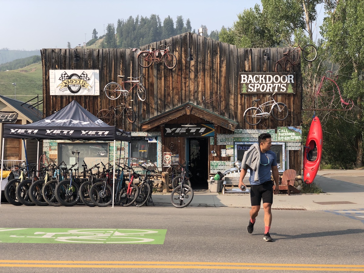
Hands are tired from seizing the handlebars, but thrilled by the speed. Morale boosted we hurry to steamboat springs. More cars as we get closer to civilization. Get to the bike shop right before they close and they confirm that they can fix it tomorrow!
We indulge in a fancy Italian restaurant for dinner. The pasta is luxurious and readily absorbed.
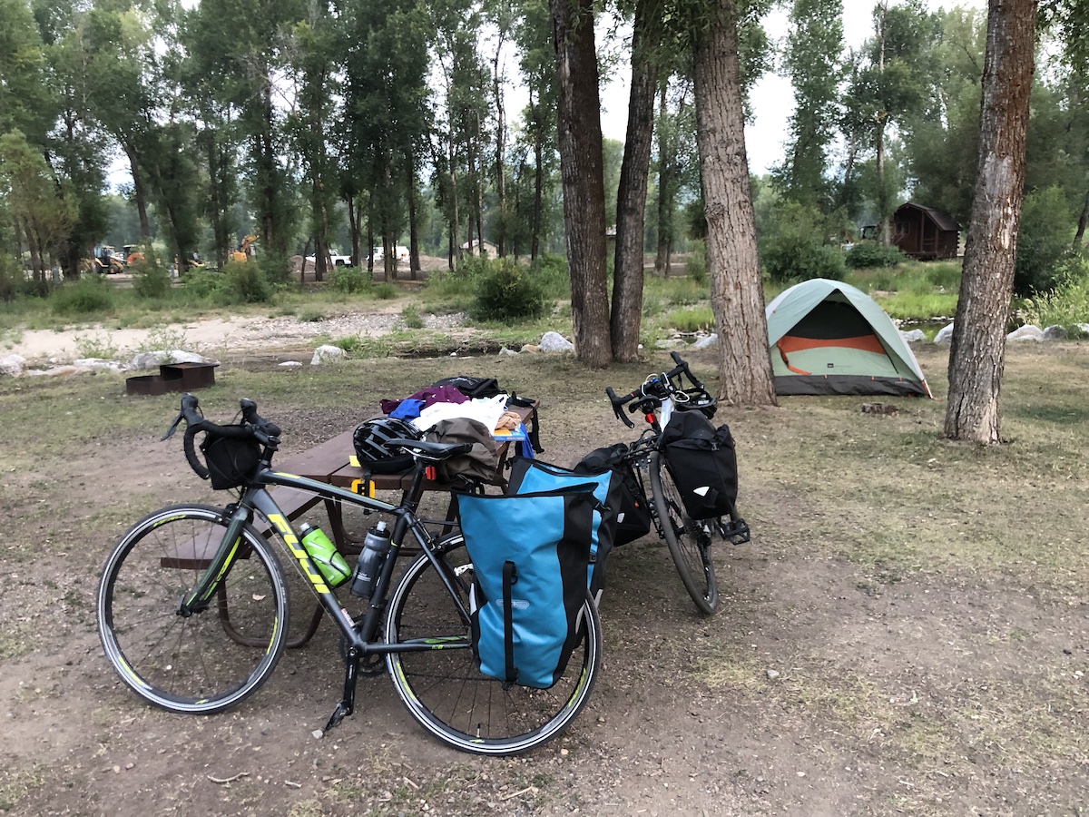
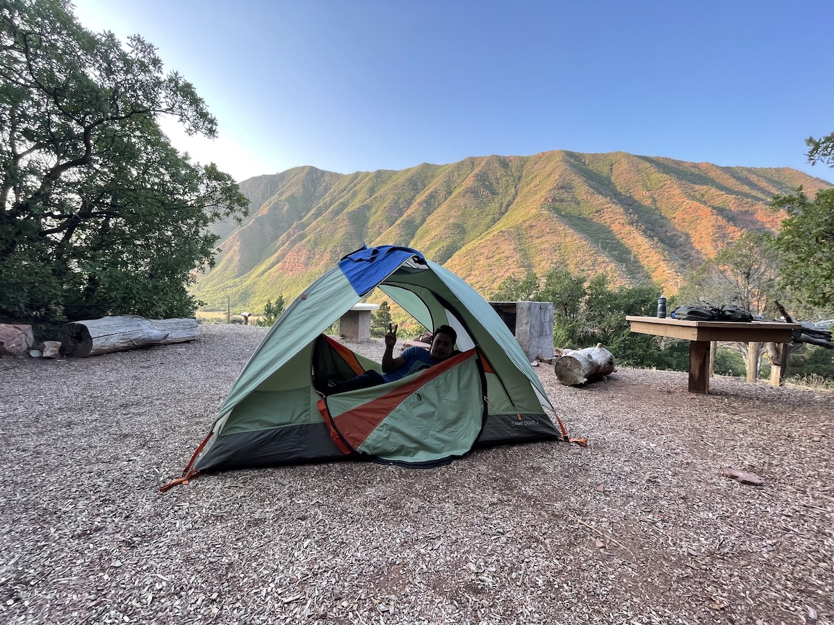
Get to the KOA and efficiently set up the tent, summoning our experience from our original pacific coast ride.
Feel a little homesick, missing being around Monica and Spice at the apartment but talking with Stephen in the tent made me feel better.
Day 4: Steamboat Springs to Rancho Del Rio
Get up a little earlier so that we can get to the bike shop when they open. Before we leave, the dad from a Chinese family camping next to us approaches. He is curious about the bikes, we chat and learn that he’s from Maryland and is doing a cross-country summer road trip while his kids are off of school. He insists that we take a few extra peaches they’ve packed as snacks.
We get breakfast at a local 50’s themed diner. I wouldn’t have thought anything of it as a kid, but with all of the context of what the 50’s was like for minorities (ethnic and cultural) in America, it adds an amusing edge to the decor. Next to the bathroom there’s a sign: “Hippies use the back door, no exceptions”
The bike shop guy reconstructs my rear hub. It’s not perfect due to damage it’s sustained from wear-and-tear but it’s much less wobbly and the mechanic assures me that the part is unlikely to suddenly, catastrophically fail. Particularly important as any sort of mechanical failure during a descent would be a disaster.
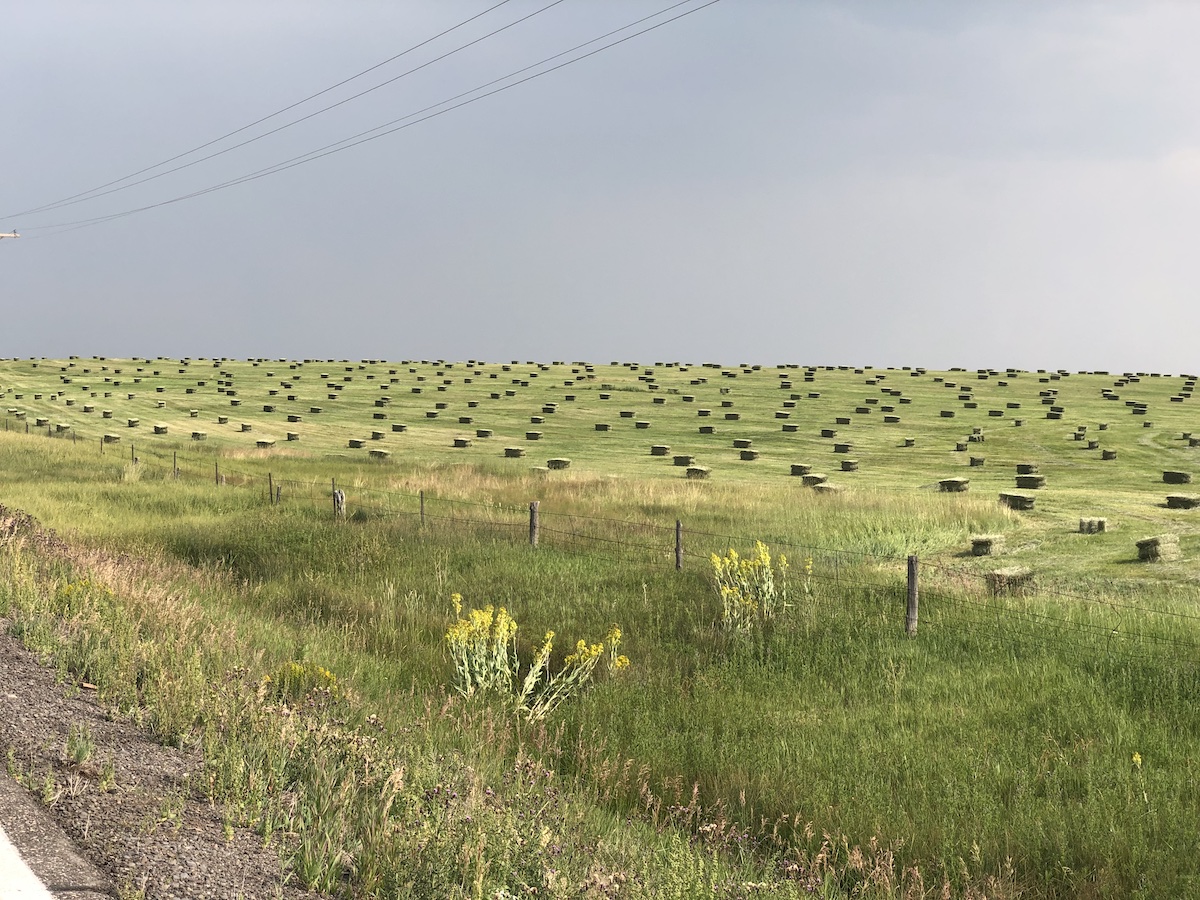
We head out of town a bit late. Stop by Oak Creek for lunch. Keep going, the road opens up into pastures with endless rows of hay in repeating geometric shapes.
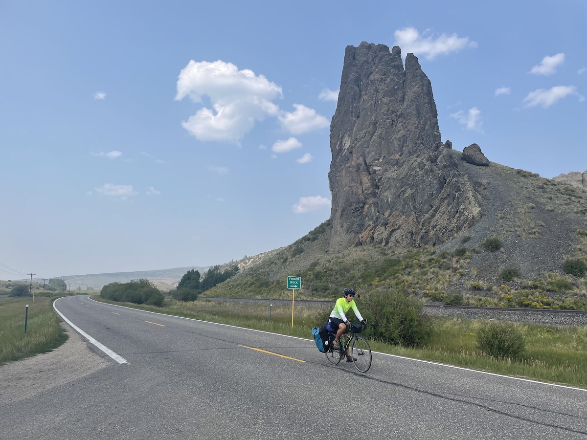
And a rock formation marked with a sign, “Finger Rock”.
The final town before State Bridge / Rancho Del Rio is Toponas. According to Wikipedia the population in 2017 was estimated to be 26 people, “all in ages ranging from 55 years upwards”. We stop by their general store, but upon opening the door we realize that all of the products are in disarray as if the store’s been hit by a hurricane. It’s strange and we high tail it out of town.
When we reach State Bridge we are elated, with only 4 more miles along the river to go, we feel like we’re practically finished with the day’s riding. Unfortunately, the last 4 miles are comprised of painfully steep inclines that I failed to anticipate. We struggle, but eventually make it to Rancho Del Rio, our destination for tonight.
Unfortunately it seems that the general store and restaurant have closed early with no employees of the campsite on site. We chat with a few other visitors staying in the cabin to ask about food options. Sadly there are none, and we can’t find showers either. We sit on the picnic tables with the sun going down, contemplating the reality that tonight we’ll have neither clean bodies or sated stomachs.
Mentally at our lowest, the cabin visitors wave us over. They’ve made ham sandwiches for us in little plastic baggies, accompanied by granola bars, donuts, and canned guava juices. We are wildly grateful for their gesture and we learn the value of kindness.
Tonight in the tent we are sticky from sunscreen and road grit, but grateful.
Day 5: Rancho Del Rio to Glenwood Springs
Cold night and I am again thankful I decided to bring Monica’s warmer sleeping bag. Stephen is not able to get good sleep and leaves the tent in the early morning to hang out near the wifi area.
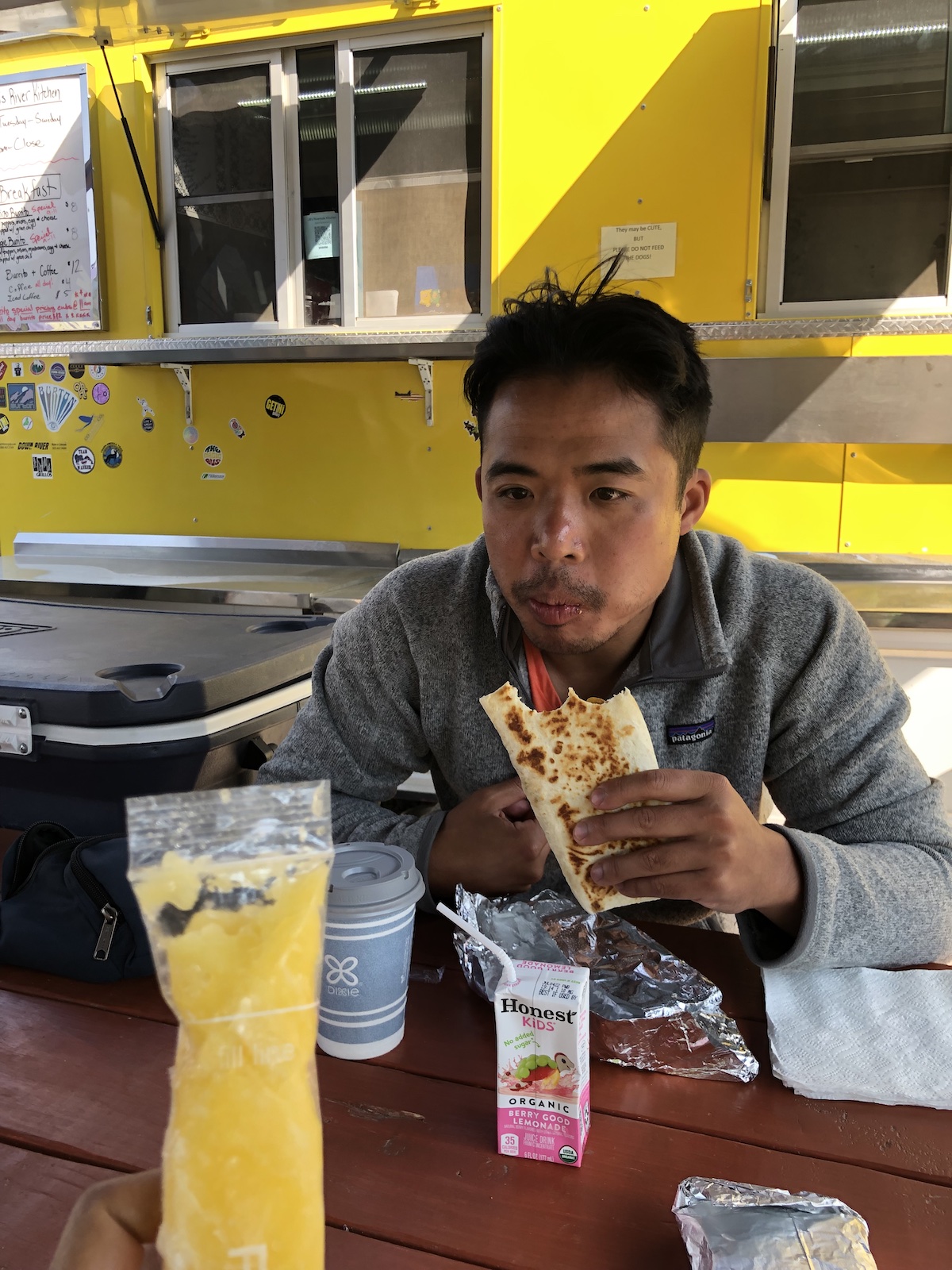
The on-site food truck opens at 9am and we get chorizo burritos and discuss our plans. We need to find a way to get to Glenwood Springs given the interstate being closed. The best plan we come up with is renting a car, and we call every company at the Eagle Airport and after many rejections, Hertz comes through so we book a pricey but worth it one day reservation to help take us from gypsum to Glenwood and then to Aspen.
Relieved to have a plan, we leave at around 11am. Stephen is fatigued from a lack of sleep and shower and the start of the ride is aggressive with many steep climbs and few descents. It’s hotter today and we are doubly sweaty. This side of the mountains is noticeably drier and scrubbier.
Many breaks taken in gravel outcroppings to catch our breath while hunched over handlebars, letting semis pass. Very little median but most vehicles give us room. It gets a little dicey when it’s 2 semis coming in opposite directions.
After about an hour of climbing we finally reach the top and cash in the potential energy for 5 free miles. No medians but having a mirror means I can take up the lane when there’s no traffic coming up behind me.
At the bottom of the hill we refill our water and get asked for directions by an old lady looking for something to eat. We mention we are from San Francisco and she says she once worked at the SF Zoo.
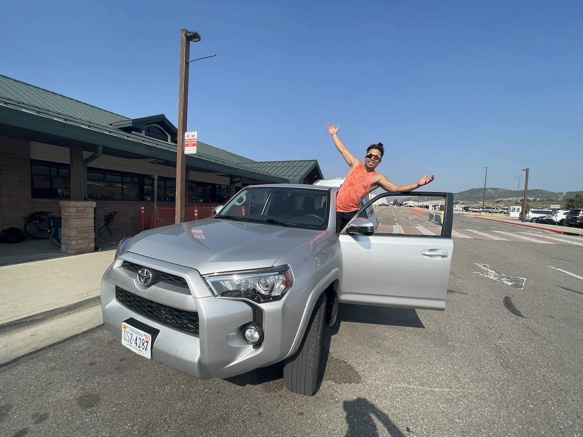
Reach a bike path and ride along the river, passing fly fisher men and women and dogs. When we start seeing buildings we search and find a Taco Bell to recarb and rehydrate. Realizing we only have an hour before Hertz closes we race to the airport and are lucky to be handed the keys to a Toyota 4Runner that can swallow up our bikes, bags, and selves.
First priority: Drive to a gas station to get Icees.
Second priority: Take the “unsafe” detour over cottonwood pass.
The pass is marked by soldiers next to humvees directing traffic. Thin, windy roads and continuous fast paced traffic assure us that paying for a car rental was absolutely the right choice.
Check into the campsite, hit a diner for dinner. Take a niiiiice warm shower. 2 days of grime dissolve into a pleasant nights sleep.
Day 6: Glenwood Springs to Aspen
I wake up with an idea: to use the remaining time on the rental car to shuttle our gear to Leadville so that we can climb Independence Pass free of extra weight.
So over eggs at Glenwood Springs, we start looking at driving distances and making a call to confirm that we can drop our bags off at the campsite. It looks possible, so we head back over Cottonwood Pass and drive for 3 hours to Leadville.
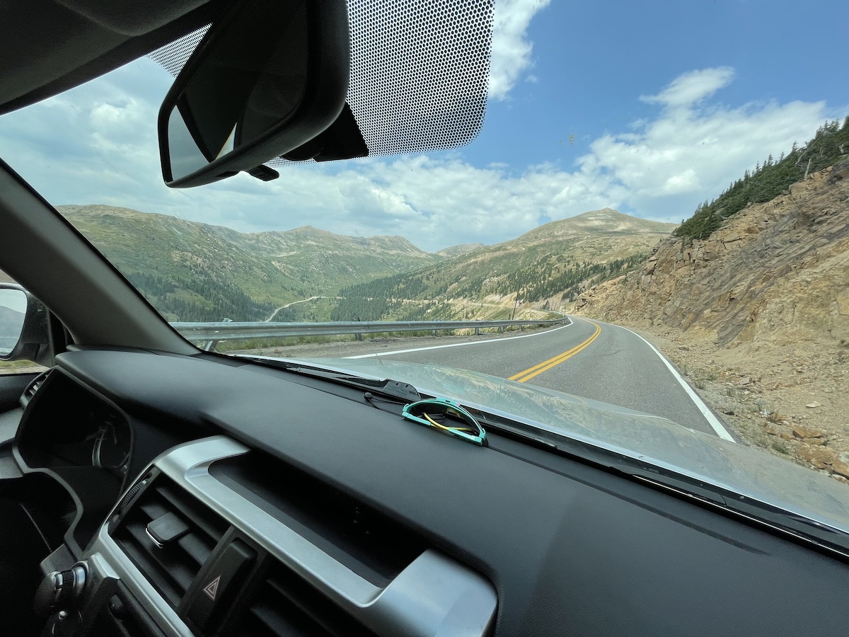
Drop off the bags, and we start to feel crunched for time. Apple Maps takes us down a forest road that eventually becomes loose gravel. After some point we realize that it’s not a good idea to continue so we turn around to head back and switch to Google Maps. Our new route heads over Independence Pass but we decide to take it because we need to return the car in time.
Driving over the pass is daunting. The scale and duration of the climb ahead of us makes us alternate between nervously laughter and silence.
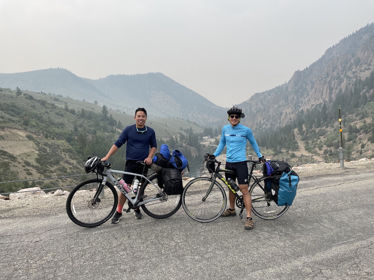
We make it to the car return in time, assemble our bikes, check into Mountain Chalet, do a little exploring of Aspen and mentally prepare for tomorrow’s big ride.
We talk to the local bike mechanic, Scottie, as he fills up our tires. We ask him about tips about the ride and at first he is dismissive but once we tell him about our tour, we gain his respect and he tells us to start as early as possible, wishing us luck.
Day 7: Aspen to Leadville
Today is the day of the final and biggest climb of the trip. We have trouble sleeping, I wake up every hour and check my watch to see how close we are to 5:30am. At 5 I notice Stephen is on his phone in bed so I get up and we eat a quick breakfast, prep ourselves and are on the road in the dim light of dawn.
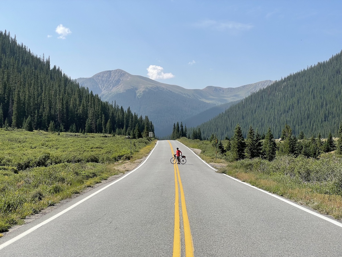
Without the sun beating down on us and with little traffic we make consistent progress. Mentally, I’m saving my energy for the final climb when the road opens up. We slowly pass by landmarks that we noted on the drive yesterday. A stoplight directing traffic along a one lane section. A campground named “Difficult”. The gate used to close the road in the winter.
With no gear and a week of acclimation, we’re able to steadily climb, taking no breaks. And as we round the corner to see the valley below it’s clear that this climb is more manageable than we thought.
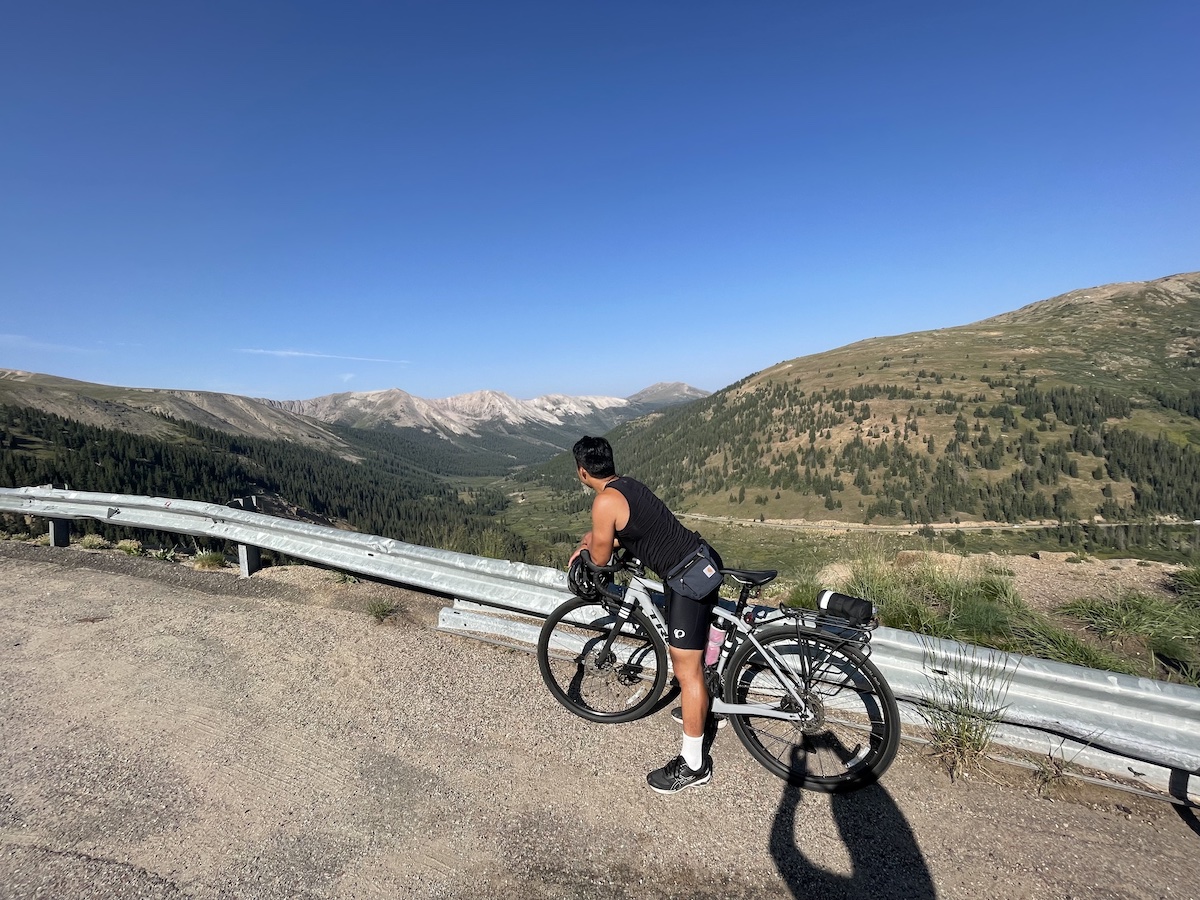
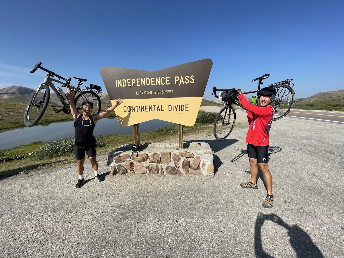
As we get closer to the top, people in their cars honk and give us the thumbs up. And at the very top, tourists ask us if we really started from the bottom. We do a photo session with the Independence Pass sign. It takes a couple of tries to figure out how to best hold the bikes above our heads.
We eat some celebratory muffins we got in Aspen the previous evening and then enjoy the spectacular descent.
Halfway down we stop at a turnout and notice a hiker walking up the road. He says he’s been hiking 30 days so far, we share that we’ve been biking for a week. We wish each other luck. Strangers bonded by adventures in the outdoors, happy to be exploring.
At the bottom we stop to eat burritos at Twin Lakes.
Later, there’s a thunderstorm ahead of us but luckily it just misses us.
It’s a tiring 30 miles to Leadville but we get there in the early afternoon. Set up the tent and phone in an order from the one restaurant in town that does delivery: ribs, pizza, wings.
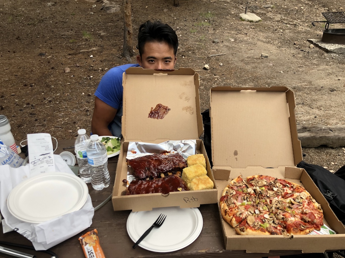
It’s too much food so we go to the campsite’s general store to give the extra pizza and wings to the employees (teenagers working their summer jobs). They’re genuinely surprised and gladly accept the food. I can tell by their expressions that they’re thrilled. It’s gratifying to surprise strangers and make new friends.
Day 8: Leadville to Frisco
Had a restful sleep for our last night of camping. The sun is already out as we pack up the tent and get ready for our final 35 miles of the tour.
It seems that just as we’re acclimating to life on the road, the trip is coming to an end. It’s bittersweet. I’m relieved that we are going home soon to creature comforts like my own bed and shower, but disappointed that the simpler challenges of food, water, distance, and elevation will be replaced by more complicated ones related to work and regular life.
On the way out, we pass through Leadville, which looks like a fun town to explore if we had time to, but we want to get to Frisco early to relax, so we rush out.
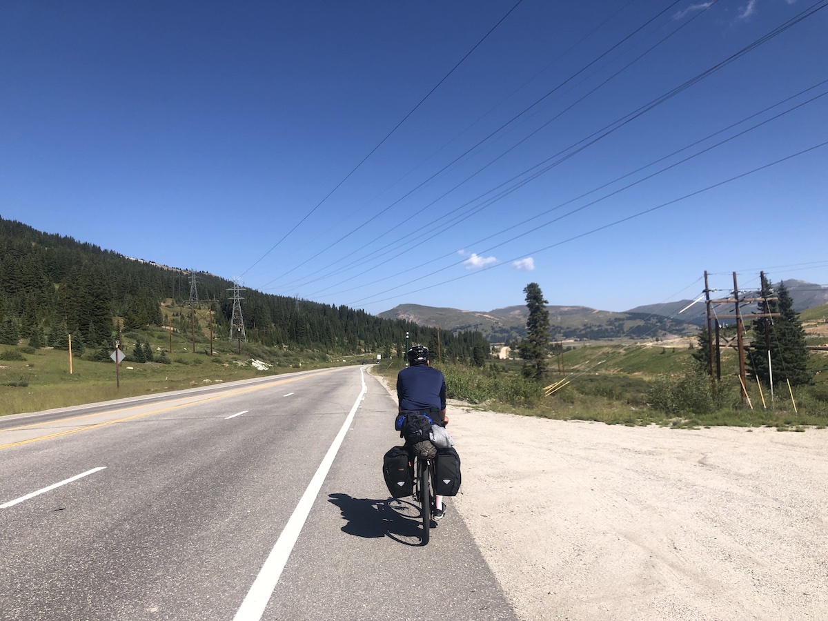
There is a final continental divide climb before the end of the tour, Fremont pass. We see many cyclists on their way back from the pass as we head toward it. Almost everyone waves or signals to us with a thumbs up, peace sign, smile, or a nod.
Climbing the pass seems harder than yesterday because of the heat and traffic but eventually we reach the top where there is a Molybdenum mine with various perplexing industrial structures.
On the way down from the pass we stop at a scenic lake next to the highway and take in the view and take some last photos.
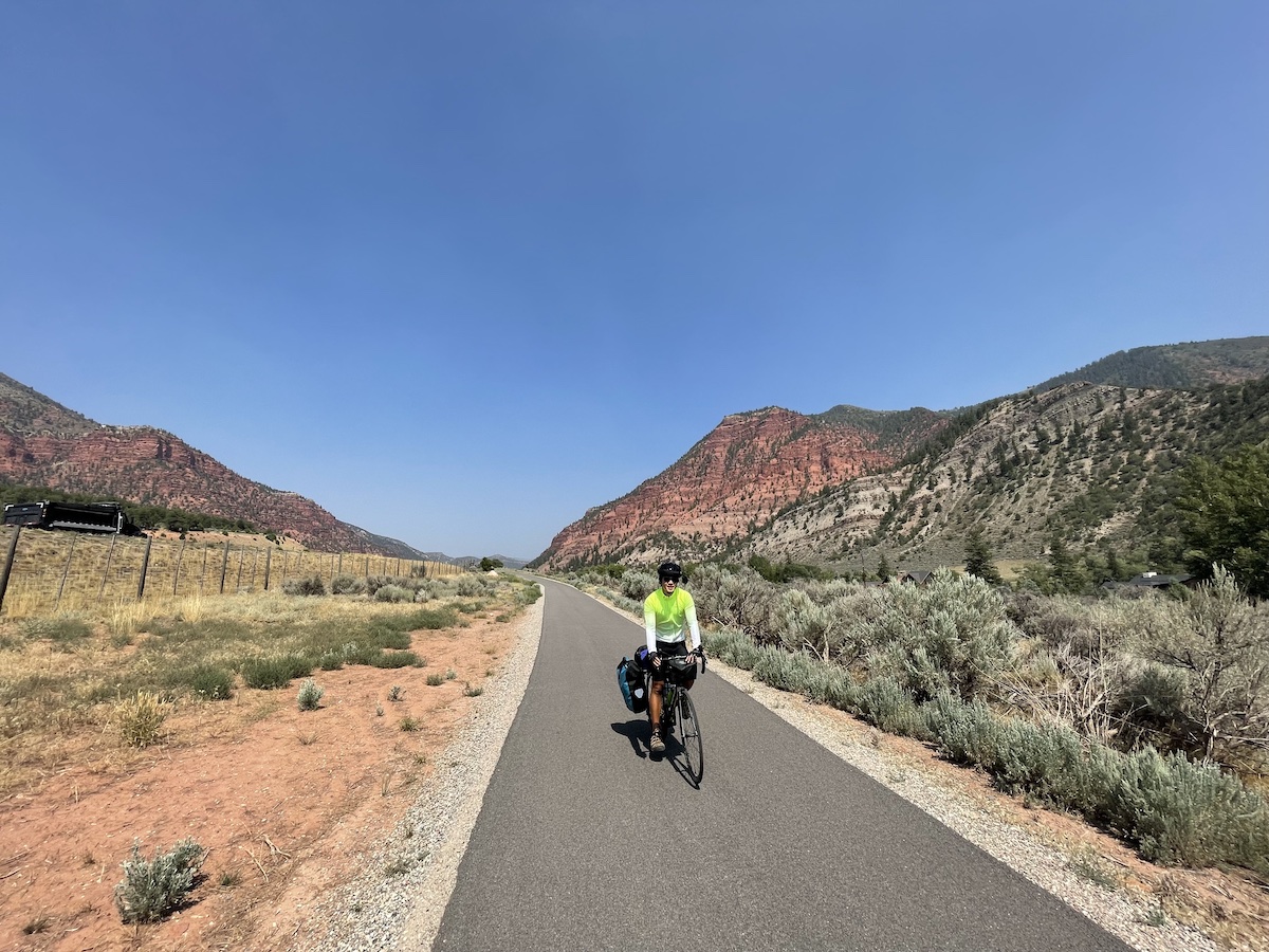
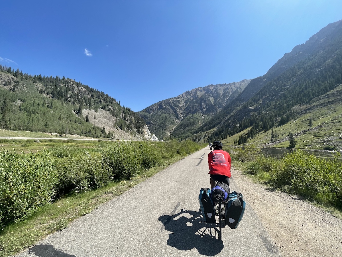
Eventually we connect to a bike trail that leads all the way to downtown Frisco and the snowshoe motel where we started. It is all downhill and although busy with other cyclists, it’s a cool and pleasant coast to town.
We check into our room early, drop off the bikes at the shop, shower, pack, and spend the rest of the day relaxing. We eat sushi, drink ice water, watch Jurassic Park on HBO, and experience awe and gratitude when a massive surprise hailstorm interrupts the movie.
Walking to the Italian restaurant for dinner, we see lightning unravel through a dark thunderhead and only then do we appreciate the good weather we had taken for granted.
The shuttle for the airport arrives early in the morning so we turn in early.
Observations and Advice
To anyone looking to do a tour of this route or any others, here are some of the things I learned on this trip.
How to Handle Altitude
One of our biggest worries before the trip was how our bodies would handle the sudden change in altitude combined with the daily mileage requirements. For us, we luckily did not run into showstopping symptoms. We took it slow to avoid going beyond our cardiovascular limits, took frequent breaks, and took care to regularly drink. A week of this slow-paced riding at altitude was an adequate amount of time to prepare for Independence Pass.
Digestion
I’m not sure whether this was related to the altitude or just the fact that I hadn’t done a lot of riding before this tour, but I had some serious digestion issues on the first few days of the trip. Eventually I got the hang of what I could / couldn’t eat and in what quantities. I settled on this general strategy: simple carb-centered foods gradually eaten in small increments, starting with larger quantities in the morning and tapering off as the day went on. For example, pancakes for breakfast, a pack of M&M’s spread throughout the day, a sandwich for lunch, and then a small non-dairy pasta meal for dinner, avoiding all deep fried or fiber-heavy foods.
Inevitability of a Flat Tire
I was surprised by my flat tire on the first day. I’ve ridden over all sorts of nasty road debris on my Schwalbe Marathon Plus’es since the last tour when I’ve had them installed. These are the typical tires for bicycle tourists due to their exterme durability, so I felt that it would be highly unlikely that I’d get a flat on this trip. But, it still happened. I was glad that I brought the spare tubes and pump!
The Generosity of Strangers
This trip would have been far more challenging without the generosity of the strangers we met along the way. I feel that popular culture often portrays adventure as an exercise in independence and self-reliance. But I’ve learned that in reality this is rare. Almost every adventure I’ve been on has been a humbling experience in seeing exactly how much we depend on each other. On this trip, we put our lives in the hands of every driver that passed us, were fed by strangers at an empty campsite, and checked on when we ran into mechanical issues on the road. It was appreciated and I hope to pay it back.